Island Images - The Isle of Man in Pictures
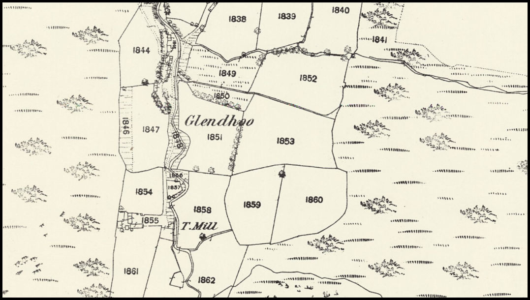
This extract from the Ordnance Survey 1870 25" map shows the area around the Glen Dhoo farmsteads, with the close-in area divided into separate fields and a Tuck Mill down by the stream.
An
Island Images
picture ©
Jon Wornham