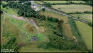
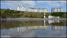
4th August
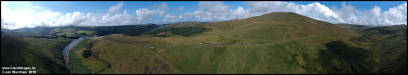
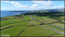
Some Aerial pictures
taken in very dull and overcast conditions, by the Onchan Centenary Park
in Birch Hill. DJI Spark 3/8/18
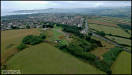  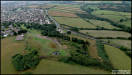  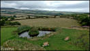
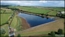
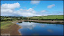
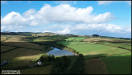
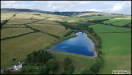
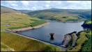
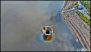
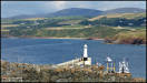
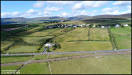
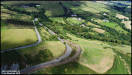
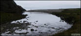
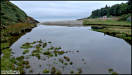
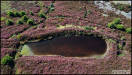
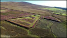
 Low water levels in
Kerrowdhoo and The Clypse Reservoirs, on the outskirts of Onchan.
DJI Spark 3/8/18
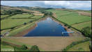
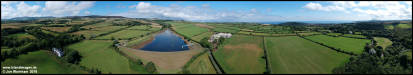
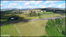
Low water levels in
Kerrowdhoo and The Clypse Reservoirs, on the outskirts of Onchan.
DJI Spark 3/8/18
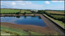    
 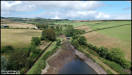   
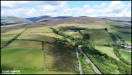
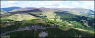
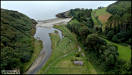
 5th August
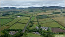
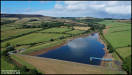
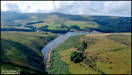
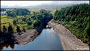
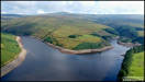
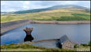
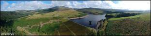
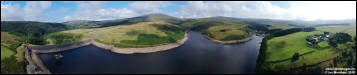
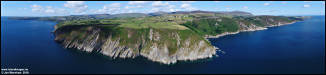
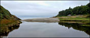
More Aerial photography
from Friday, this time of the Sulby Reservoir. DJI Spark 3/8/18
5th August
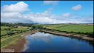
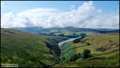
More Aerial photography
from Friday, this time of the Sulby Reservoir. DJI Spark 3/8/18
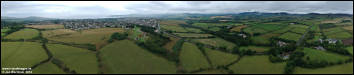
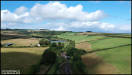
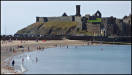
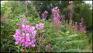
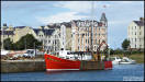
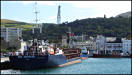
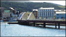
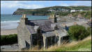
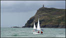
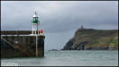
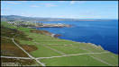
  6th August
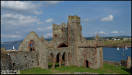
A visit to Peel yesterday
afternoon. Panasonic FZ72 5/8/18
6th August
A visit to Peel yesterday
afternoon. Panasonic FZ72 5/8/18
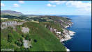
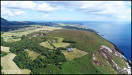
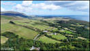
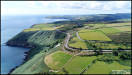
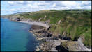
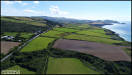
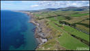
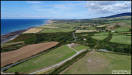
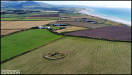
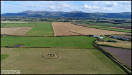
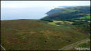
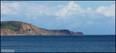
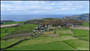
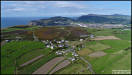
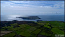
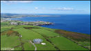
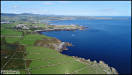
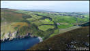
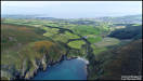
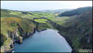
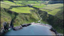
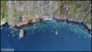
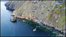
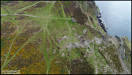
     10th August
Some aerial pictures
taken in the area of Bulgham Bay and Ballaragh, just north of Laxey.
Many thanks to Mr & Mrs Quilleash who farm Loaghtan sheep here for
permission to fly from their land and for suggesting the second flying
site. DJI Phantom 4 Pro 9/8/18
Ballaragh
Farm Web Page
10th August
Some aerial pictures
taken in the area of Bulgham Bay and Ballaragh, just north of Laxey.
Many thanks to Mr & Mrs Quilleash who farm Loaghtan sheep here for
permission to fly from their land and for suggesting the second flying
site. DJI Phantom 4 Pro 9/8/18
Ballaragh
Farm Web Page
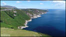  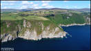  
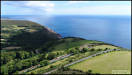    
  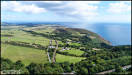  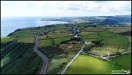
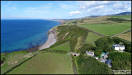
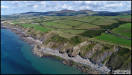
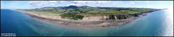
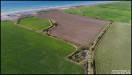
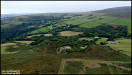
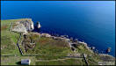
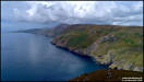
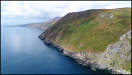
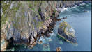
  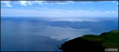 12th August
More aerial photography
from Thursday, this time in the afternoon at the Lhiannag area on the west
coast, looking at the coastline and the former track of the Manx Northern
Railway that passed very close to the sea at this point. DJI Phantom
4 Pro 9/8/18
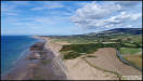
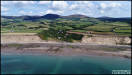
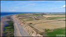
12th August
More aerial photography
from Thursday, this time in the afternoon at the Lhiannag area on the west
coast, looking at the coastline and the former track of the Manx Northern
Railway that passed very close to the sea at this point. DJI Phantom
4 Pro 9/8/18
 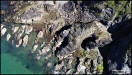   
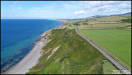    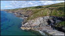
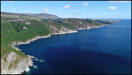
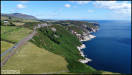
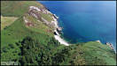
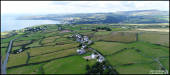
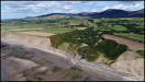
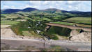
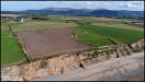
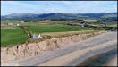
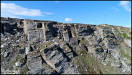
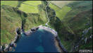
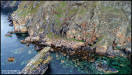
 13th August
Third set of Aerial
pictures from Thursday afternoon, a bit further north on the west coast
at Glen Mooar. DJI Phantom 4 Pro 9/8/18
13th August
Third set of Aerial
pictures from Thursday afternoon, a bit further north on the west coast
at Glen Mooar. DJI Phantom 4 Pro 9/8/18
   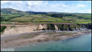 
 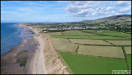  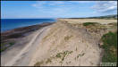
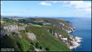
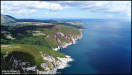
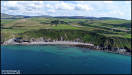
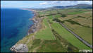
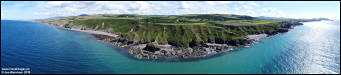
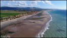
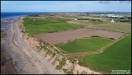
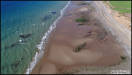
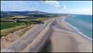
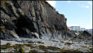
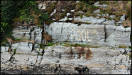
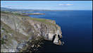
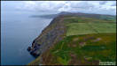
 14th August
More Aerial pictures
from Thursday afternoon, this time in the Jurby Head area. DJI Phantom
4 Pro 9/8/18
14th August
More Aerial pictures
from Thursday afternoon, this time in the Jurby Head area. DJI Phantom
4 Pro 9/8/18
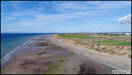    
   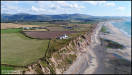 
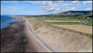
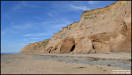
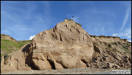
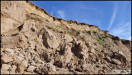
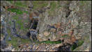
 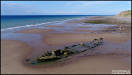 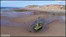 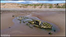 Some ground level pictures
of the eroding sandy cliffs between Jurby Head and The Cronk. Panasonic
TZ60 9/8/18
Some ground level pictures
of the eroding sandy cliffs between Jurby Head and The Cronk. Panasonic
TZ60 9/8/18
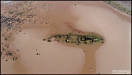
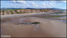
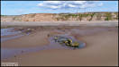
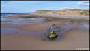
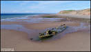
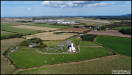
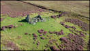
     Back in the air again
to take a look at two former farmhouses that have now been abandoned.
DJI Phantom 4 Pro 9/8/18
Back in the air again
to take a look at two former farmhouses that have now been abandoned.
DJI Phantom 4 Pro 9/8/18
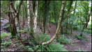
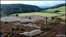
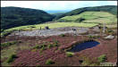
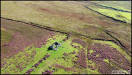
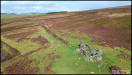
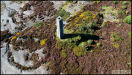
     15th August
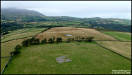
A walk in the hills
just north of the Dhoon Glen to try and locate an old Keeil site marked
on the 1870 Ordnance Survey map but missing from more recent ones.
There was also a nearby stone circle marked on the old map but again missing
from newer ones. I was unable to reach the Keeil site on foot due
to not wanting to risk damaging stone walls by climbing over, but I had
the Spark drone with me and was able to take some aerial pictures.
DJI Spark 12/8/18
15th August
A walk in the hills
just north of the Dhoon Glen to try and locate an old Keeil site marked
on the 1870 Ordnance Survey map but missing from more recent ones.
There was also a nearby stone circle marked on the old map but again missing
from newer ones. I was unable to reach the Keeil site on foot due
to not wanting to risk damaging stone walls by climbing over, but I had
the Spark drone with me and was able to take some aerial pictures.
DJI Spark 12/8/18
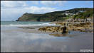
    Some ground level pictures
walking back to the car. Panasonic TZ60
Some ground level pictures
walking back to the car. Panasonic TZ60
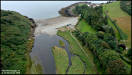
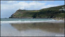
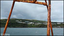
     Heading onwards to nearby
Port Cornaa for some ground and aerial photography. Panasonic TZ60
& DJI Spark
Heading onwards to nearby
Port Cornaa for some ground and aerial photography. Panasonic TZ60
& DJI Spark
   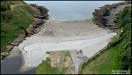 
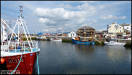
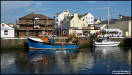
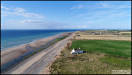
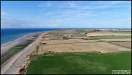
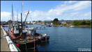
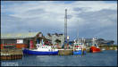
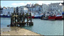
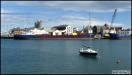
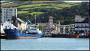
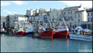
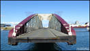
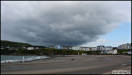
 17th August
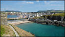
Pictures taken in Ramsey
yesterday afternoon, mainly around the harbour area. Panasonic TZ60
16/8/18
17th August
Pictures taken in Ramsey
yesterday afternoon, mainly around the harbour area. Panasonic TZ60
16/8/18
 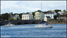   
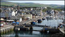
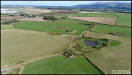
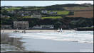
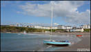
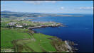
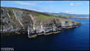
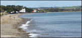  24th August
A visit to Port Erin
yesterday afternoon. Nikon D7100 23/8/18
24th August
A visit to Port Erin
yesterday afternoon. Nikon D7100 23/8/18
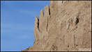
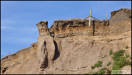
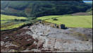
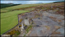
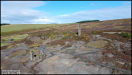
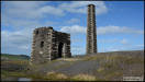
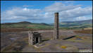
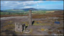
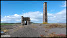
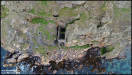
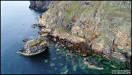
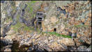
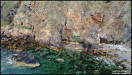
 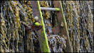   Some Aerial pictures
of Beckwith's Mine, a nearby tholtan and Cross Vein Mine (Snuff the Wind)
- DJI Spark 23/8/18
Some Aerial pictures
of Beckwith's Mine, a nearby tholtan and Cross Vein Mine (Snuff the Wind)
- DJI Spark 23/8/18
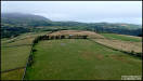
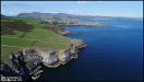
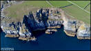
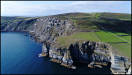
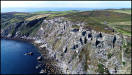
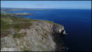
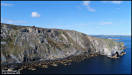
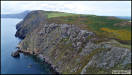
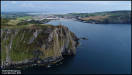
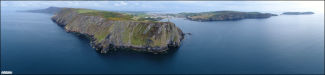
    26th August
Aerial photography in
the area of Cregenash and The Chasms, flying from three locations yesterday
afternoon. DJI Phantom 4 Pro 25/8/18
26th August
Aerial photography in
the area of Cregenash and The Chasms, flying from three locations yesterday
afternoon. DJI Phantom 4 Pro 25/8/18
   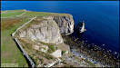 
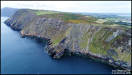
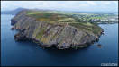
 31st August
Some Aerial pictures
from yesterday afternoon at Fleshwick Bay, flying from the headland to
the south of the bay. DJI Phantom 4 Pro 30/8/18
31st August
Some Aerial pictures
from yesterday afternoon at Fleshwick Bay, flying from the headland to
the south of the bay. DJI Phantom 4 Pro 30/8/18
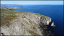
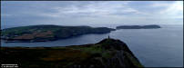
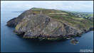
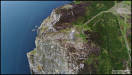
   1st September
More Aerial pictures
from Thursday afternoon, moving south from the first location to concentrate
on the area around the old North Bradda Mine.
DJI Phantom 4 Pro
30/8/18
1st September
More Aerial pictures
from Thursday afternoon, moving south from the first location to concentrate
on the area around the old North Bradda Mine.
DJI Phantom 4 Pro
30/8/18
  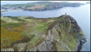  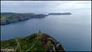
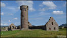
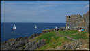
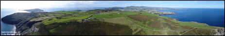
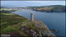
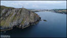
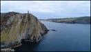
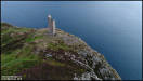
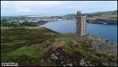
 The final flight on
Thursday afternoon, taking a closer look at Bradda Head and the Milner
Tower. DJI Phantom 4 Pro 30/8/18
The final flight on
Thursday afternoon, taking a closer look at Bradda Head and the Milner
Tower. DJI Phantom 4 Pro 30/8/18
|