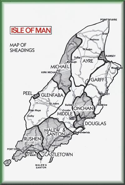
The older pictures
are divided into rough areas based on the political 'Sheadings',
which originate in the original Norse division of the island
into six parts.
This isn't a political statement,
just a rough way of indexing the pictures by area, so sorry if I've
put any into the wrong Sheading. Map links on the following pages
are to an external site.